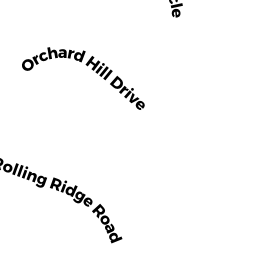
6 ROLLING RIDGE RD
Owner Information
GRATTON MARK & DICKSON ELIZABETH
6 ROLLING RIDGE RD
RUTLAND, MA 01543


Property Details
6 ROLLING RIDGE RD is classified as a Single Family Residential (Cape cod).
The primary structure on this property was built in 1992. There are 2,832ft2 of built area within this property. There is 1,512ft2 of residential/living space within this property. This property is listed as having 6 rooms.
6 ROLLING RIDGE RD is valued at $260,000. The land is valued at $64,100 and the structures are valued at $194,800. There is an additional valuation of $1,100 on this property.
The most recent deed for 6 ROLLING RIDGE RD is recorded at the local registrar in Book 53467, Page 0363. 6 ROLLING RIDGE RD was last sold on Friday, March 13, 2015 for $242,500.
Assessment data from fiscal year 2021.
Flood Data
According to the FEMA National Flood Hazard Layer, this property does not appear to be in a flood zone. It may also be in an area not yet reviewed. Nonetheless, confirm this information prior to taking any action.
To view the flood hazards around this property, create a FEMA "Firmette" Map of the area around 6 ROLLING RIDGE RD.
Broadband Internet Providers
| Provider | Type | Bandwidth (mbps) | |
|---|---|---|---|
| Verizon New England Inc. | DSL | 10 | 1 |
| Viasat Inc | Satellite | 100 | 3 |
| VSAT Systems, LLC. | Satellite | 2 | 1 |
| HughesNet | Satellite | 25 | 3 |
| GCI Communication Corp. | Satellite | 0 | 0 |
| Charter Communications Inc | Cable | 940 | 35 |
Broadband service provider data from December 2020.
Adjacent Properties
- 26 ORCHARD HILL DR
Single Family Residential owned by BELLIVEAU BRAD T - 4 ROLLING RIDGE RD
Single Family Residential owned by ESTEVES ROBERT B - 30 ORCHARD HILL DR
Single Family Residential owned by DESROCHES JOSEPH E - 28 ORCHARD HILL DR
Single Family Residential owned by KIRRANE PAUL B. - 8 ROLLING RIDGE RD
Single Family Residential owned by LONG WILLIAM S